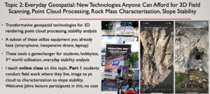
Geospatial includes remote sensing 3D imaging technologies such as Lidar, photogrammetry, and multispectral and thermal imaging. These technologies can produce high resolution 3D point clouds, from which point cloud processing software is used to extract detailed and in some cases automated rock mass characterization and slope stability outputs. When I started in this field in the early 2000s, 3D imaging and point cloud processing was expensive and time consuming. Lidar scanners cost $100k-$200k, a Lidar survey required numerous surveyed ground control points, and point cloud processing was a manual and time-consuming process. This limited its use to companies that could afford the time and expense. Today, high resolution registered point clouds can be obtained in minutes using iPhone lidar or smartphone pictures, and semi-automated point cloud processing procedures in open-source software are now routinely used to extract rock characterization information. Photos from inexpensive drones can produce very high quality point clouds of large areas, and these surveys can be repeated to monitor degradation and movement. In this Jahns lecture I will discuss modern “everyday” geospatial tools that are transforming many aspects of applied geology, and give examples of the step by step process involved to go from field imaging to final rock mass characterization and slope stability. I will also mention an online class that I teach to students around the world, where students conduct field scanning and point cloud processing in the area where they live. I invite students and young professionals in the Jahns lectures I give to participate in this class, at no cost.

